


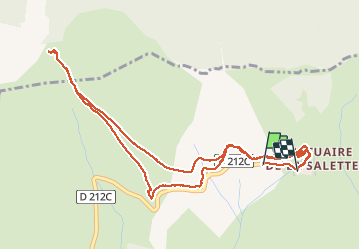
La Salette-Fallavaux Marche à pied

Krystoff Radisson
User


2h07
Difficulty : Medium

FREE GPS app for hiking
 SityTrail
IGN / Geographical institutes
SityTrail Plus
The world is yours!
About
Trail Walking of 6.6 km to be discovered at Auvergne-Rhône-Alpes, Isère, La Salette-Fallavaux. This trail is proposed by Krystoff Radisson.
Description
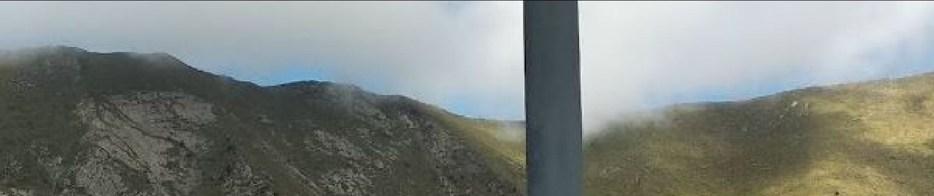
Une balade incontournable à proximité de Notre Dame De La Salette. Vertige s'abstenir, et être correctement chaussé. Les bâtons, ou une cane, sont un plus. Non seulement, la Marche A Pied est excessivement jolie, elle offre un panorama extraordinaire, mais en plus on obtient une vue plongeante et agréable sur Notre Dame De La Salette. Sur place, à Notre Dame De La Salette, une formidable boutique est présente, et on peut se restaurer correctement pour un menu de 13 € 50. La marche a été effectuée très très doucement et avec délectation du paysage. Elle a été faite en 2 h 45. Sublime.
Photos


26 photos in total. Please click on a photo to see them all in the gallery.
Positioning
Comments